


Welcome to the latest edition of the monthly release roundup! Dive right into new Nextmv SDK and Nextmv Cloud features.
SDK: Polylines for OSRM measure
What are polylines?
The OSRM measure can now retrieve polylines. For SDK customers, this means that the function returns a polyline from the first to last point of the route as well as a slice of polylines (one for each leg of the route).
When should I use polylines?
Use polylines if you want to plot out the exact routes returned by the OSRM measure with a mapping service or frontend of your choice. Polylines are returned in Google’s polyline format.
How can I get started with polylines?
If you’re already an SDK customer, you’ll need to upgrade to v.015.1.
If you aren’t an SDK customer yet, reach out to us to get started.
Learn more about polylines for OSRM.
Nextmv Cloud: Polylines in output for Streets & Haversine
What are polylines on Nextmv Cloud?
For Nextmv Cloud, polylines are available in the output for the Streets integration and the Haversine measure. The JSON output includes a polyline from the first to last point of the route as well as a slice of polylines (one for each leg of the route).
When should I use polylines on Nextmv Cloud?
These returned polylines allow you to use a mapping service to plot out your exact routes when using the Haversine measure or the Streets integration. Polylines for all are returned in Google’s polyline format.
How can I get started with polylines on Nextmv Cloud?
Polylines for Streets (hosted OSRM): Sign up for a free Nextmv Cloud account and then reach out to us to get access to the Streets integration.
Polylines for Haversine: Sign up for a free Nextmv Cloud account and the polylines will automatically be returned in the JSON output.
Learn more about the polylines output in Nextmv Cloud.
Nextmv Cloud: Onfleet integration UI update
We recently released an option to toggle compatible Onfleet features on or off. Now the same functionality is possible via the UI in the Nextmv Cloud console. Simple toggle off “Parse compatible Onfleet features” and then select which features you’d like to parse.

Learn more about the Onfleet integrations compatible features.
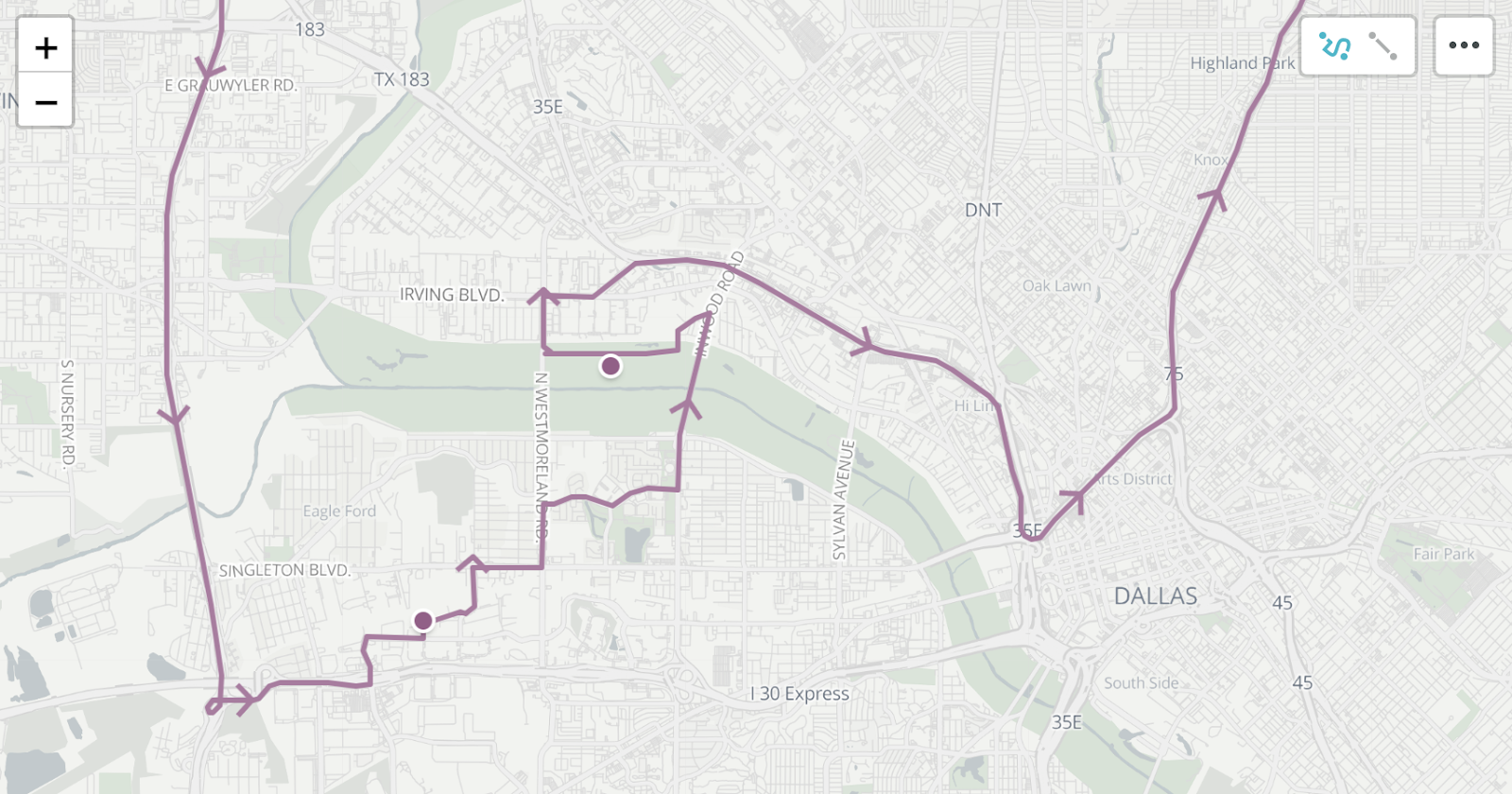
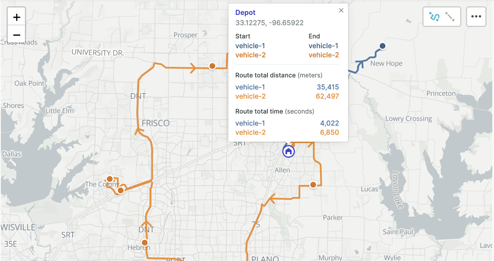
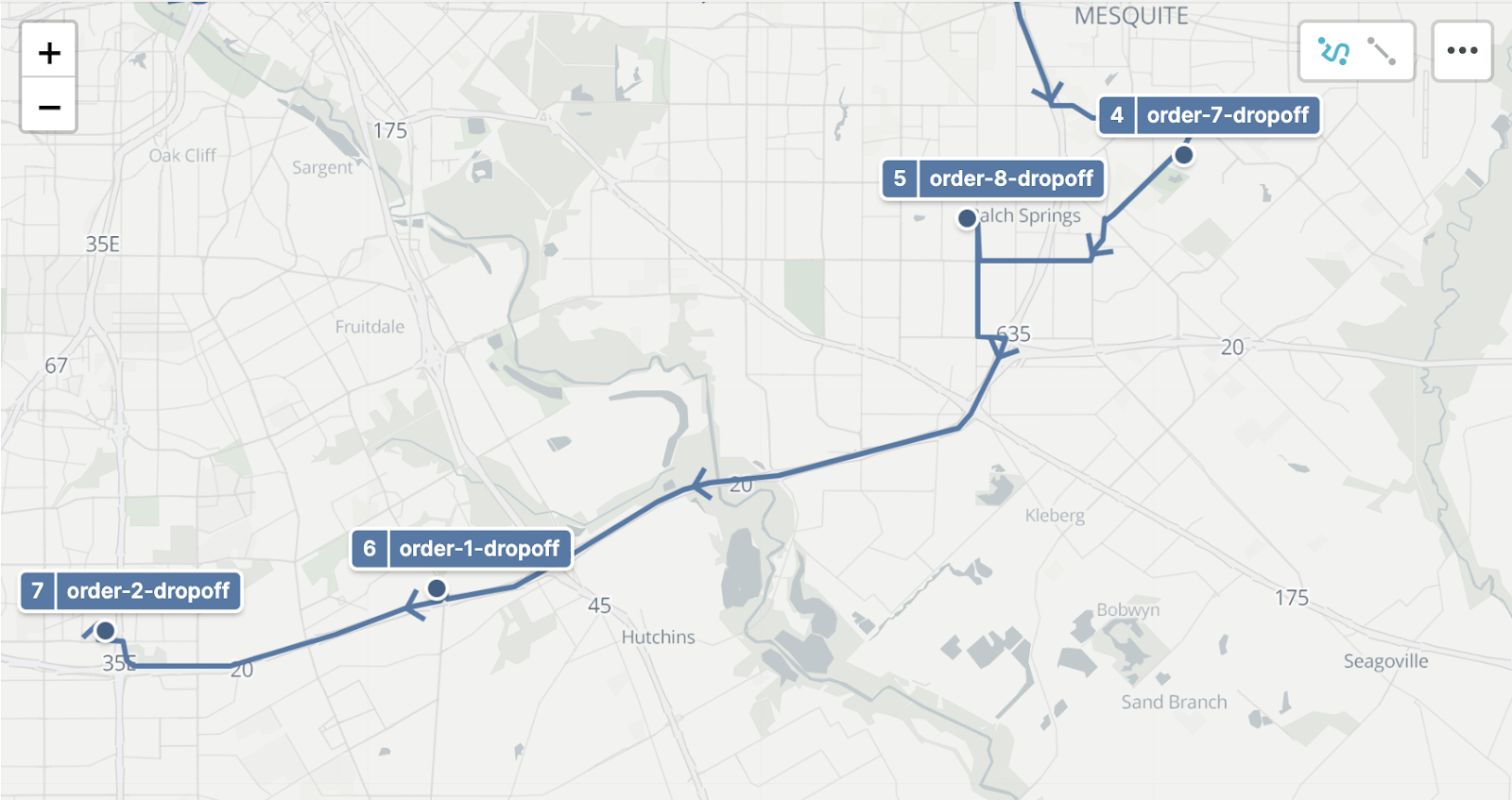
Nextmv Cloud: Map console updates
Route arrows
New arrows on the map show directionality of a route. These can be turned on or off using the menu in the top right corner of the map.
Enhanced tooltips
Hovering over or clicking on a stop on the map will now include the following:
- Geographic details (latitude / longitude)
- Estimated time of arrival (ETA)
- Total distance traveled for the vehicle (when clicking on depots)
- Total time elapsed for the vehicle’s route (when clicking on depots)
Stop annotations
When a solution is returned, you can now see the name of the stop along with the order in which it will be visited along the route. These annotations are turned off by default and can be turned on or from the menu in the top right corner of the map.
See the map updates in action on Nextmv Cloud.
Get started
Sign up or log in to Nextmv Cloud and try the Onfleet features out today!
Ready to get started with the SDK routing engine? Want to learn more about other use cases? Contact us to chat with our team.


